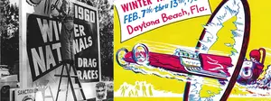

Back on the ghost-track trail
Like haunted houses full of the spooky apparitions for which they are named, it seems that there's no exorcising the demand for ghost tracks at casa DRAGSTER Insider, so here we go again. If you don't already have it, download a copy of Google Earth so that you can play around. If you're not familiar with the free program, go to my Oct. 17 entry to see what it can do and how best to use it. It makes this whole ghost-track thing much more fun.
Okay, and away we go.
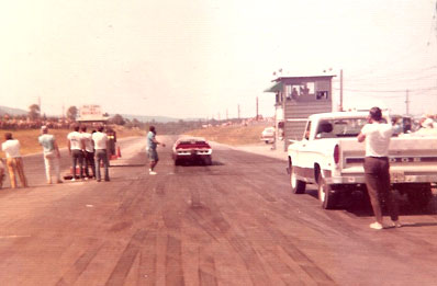
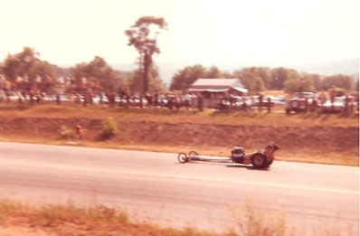
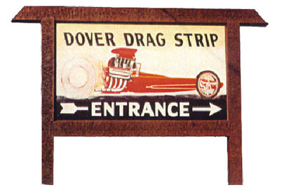
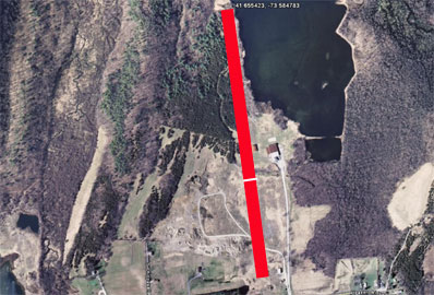
Marie Taney sent these two shots of Dover Drag Strip, which Chet Anderson and Joe Archiere built on 144 acres in
"I am told Dover Drag Strip is a gravel pit now, but back in my early teens, it was a great place to spend a Sunday and not get into trouble," she recalled. "It was $1 to enter and $3 for a pit pass. Afterwards, the racers would go to Josey's Tavern on the Ten Mile River just down the road in Wingdale. I had forgotten all about the place until last summer I was visiting a friend in LA, and he suggested the NHRA museum in
A couple of really good sites are dedicated to
Here are the coordinates for the starting line, supplied by our friends at the TerraTracks Global Authority: 41.645960, -73.582969. Enter them in your Google Earth FlyTo box. Not much to see anymore, maybe just some of the old shutdown area.
 |  |
 |  |

Staying with the Empire State, we turn our attention to Westhampton Dragstrip, which opened in 1953 as a dirt dragstrip on
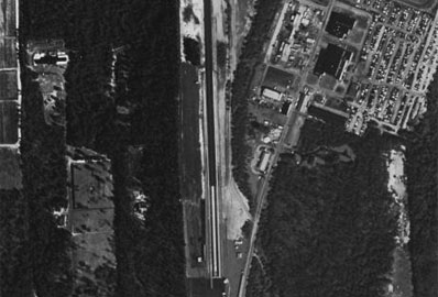
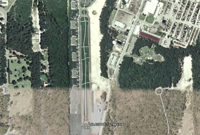
Westhampton became a housing development called Westhampton Pines. I found an aerial photo of the track before it disappeared using Microsoft TerraServer images, which can be seen below left. If you use Google Earth and enter 40.827466, -72.684776, you can see how it looks today. I'm pretty sure that's the starting line that is still pretty visible, and if you have your Roads button (in the bottom left corner of Google Earth) checked, you can see that at least there's a street that runs into the development off Old Country Road called Drag Street. Nice!
 |  |

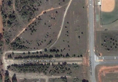 |
Alan Ridenoure used to race at Warner Robins in Warner Robins, Ga., when he was a kid but says that the site of the strip is now a high school and that the starting line is the eastern end zone of the football stadium. Looking at this Google Earth image (which was shot from space Oct. 23, 2006, more than two years ago), I see the school but not the stadium. I remember Warner-Robins because in the weekly reports we received here at ND, it always looked as if there were a median of grass between the two lanes, and looking at these images, you can clearly see two lanes separated by something. I'm not sure if the track ran west-east, but the TerraTracks Global Authority lists the starting line here: 32.550154, -83.681147. It almost looks as if Bear County Boulevard was built and bisected the track just a tenth of a mile from the starting line and that the track (which was an eighth-mile facility) continues on as an unnamed street beyond that. Weird.
There's a surprising lack of good information about the track on the Web, even though I know the track has not been gone long. The track held an NHRA Division 2 event for years, and looking back through old issues of National DRAGSTER, I see that it dropped off the roll of member tracks in 1996, but I'm not sure if that's when it died or if it changed sanctions.

Also from the
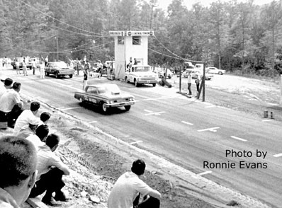
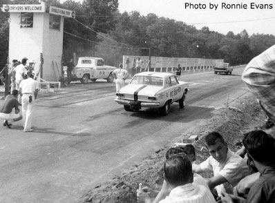
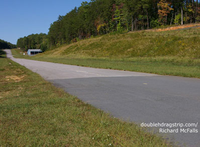
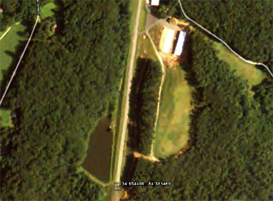
The site has a lot of old photos and some shots of the track as it currently sits; it is now an airstrip for a fly-in residential community. The site also has a Google Earth image of the track (no coordinates), but after a couple of minutes of exploring my map for similar features, I found it here: 34.854499, -84.383469. That's how it looks in the lower right picture, and from ground level at lower left are two of the great shots from the track site. The white building at the end of the track -- which other than extensions at both ends, remains unchanged after 40 years -- is a hangar.
There are a ton of old newspaper articles on the site -- Double H Drag Strip co-founder Bill Hembree wrote a weekly article for the local newspaper, the McCaysville,
 |  |
 |  |

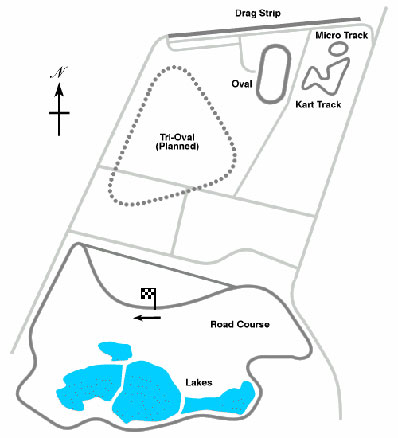
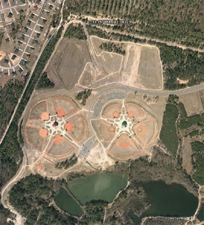
And on to yet another great Georgia facility of the past: Augusta Int'l Raceway, which featured not just a quarter-mile dragstrip but also a three-mile banked road course, half-mile paved oval, eighth-mile "micro track," motocross track, and kart track. The facility in
 |  |

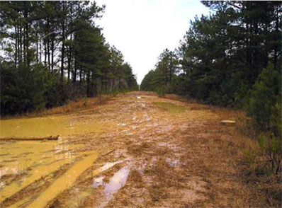
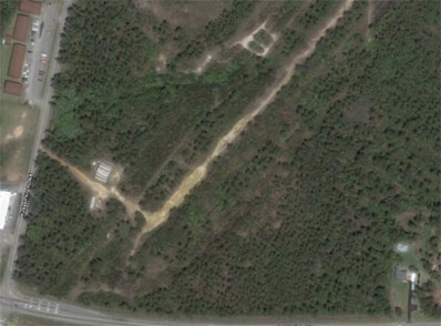
Okay, jump into your Google flying machine, and let's head to Mississippi and Biloxi Dragway. Mark Follweiler remembers well his first trip to the drags, at age 7. "My first trip to the races was 1967. My dad had passed away the year before, and my mom thought it would be a good idea for me to see the drags. We lived about five miles from the old
At www.biloxidragway.com, you can find a great photo gallery of cars from throughout the years at the track, which operated as either an NHRA or AHRA strip from Sept. 1, 1957, through the end of 1967, when the land owner refused to renew the lease. The picture at below left was taken by our old pal Bret Kepner on a cold and rainy (and very muddy) day and shows the track cutting its way through a swath of trees. The photo at below right is a Google Earth image of the same (location: 40.827466, -72.684776).
 |  |

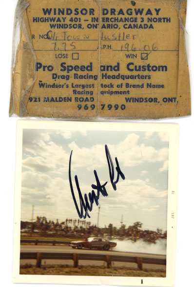
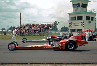
Moving north of the border, Ron Hier sent this cool remembrance of Windsor Dragway, which opened Aug. 25, 1968, just 15 minutes from downtown
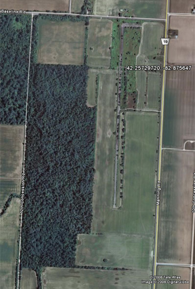
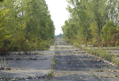
The track, located at 42.25729720, -82.875647, is still pretty visible and easily accessible off
 |  |
 |  |

Gregg Lether and his wife recently headed out into the
"Man oh man Phil, where do I start with the emotions and feelings that I felt just being there," he wrote. "Although I was never able to go there during the track's heyday, I did look at some pictures of the track I found online before we went out. Just being there and imagining all the cars, drivers, and crew, I felt like I had gone back in time. It was really an amazing and emotional experience. I could almost see the Pay-N-Pak floppy with Hall and Ruth there. That was the first car I ever saw and never lost the passion for the sport."
Below are early photos from the track, followed by some of Lether's "now" shots and an undated aerial of the forlorn site as viewed in the Birds Eye view in Microsoft's Live Search Maps program (a fine alternative to Google Earth, though not all locations have Birds Eye). To make a beeline to Beeline, FlyTo 33.507320, -111.766725.
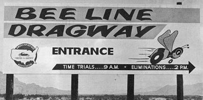 | 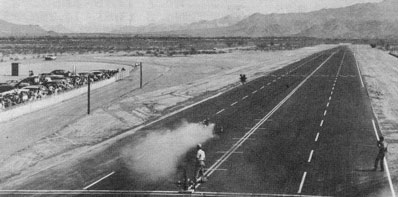 |
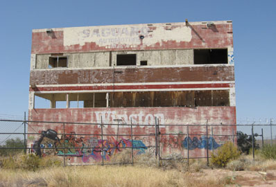 | 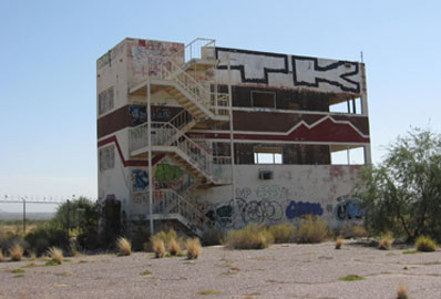 |
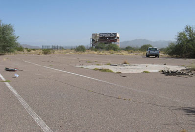 | 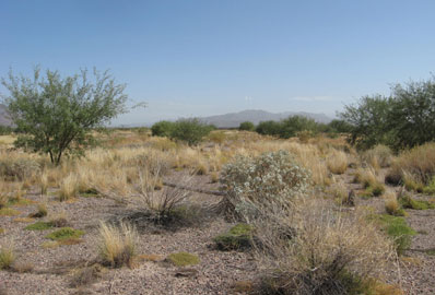 |
 | |

 |
Tracy Arakaki, an executive producer for an independent motorsports show in
"The track was perfectly up and running," he wrote. "The former landlord who held the master lease sold the option to purchase for $5 million, then for the past five years tried to get a tax credit of $50 million to acquire a parcel owned by the state to build another track on an active airport runway, which we know will never happen. A movement was formed to condemn the property through the City Council, then the former landlords who were now the managers tore up all the asphalt and burned down the tower (right) just in case the condemnation succeeded to mess things up.
"Lots of history at HRP. Roland Leong with driver Johnny West still has the track record at 5-teens, and the Desert Rat Funny Car crashed, and the front end was used as a clock and presented to someone at some awards banquet on the mainland."
Take your own all-expenses-paid trip to
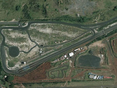 | 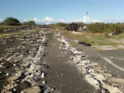 |
Speaking of aloha, that's it for the week. I hope you enjoyed another spooky trip down the quarter-miles of old. We have a busy week ahead of us with the NHRA Softball Classic Wednesday (I'll have live coverage from the ballpark!) and the Finals beginning Thursday. It's almost hard to believe the season is over -- after we send next week's National DRAGSTER Wednesday, only three issues remain -- and the long, cold winter will begin. Hang around here, though, and I'll try to keep at least your memories warm.


